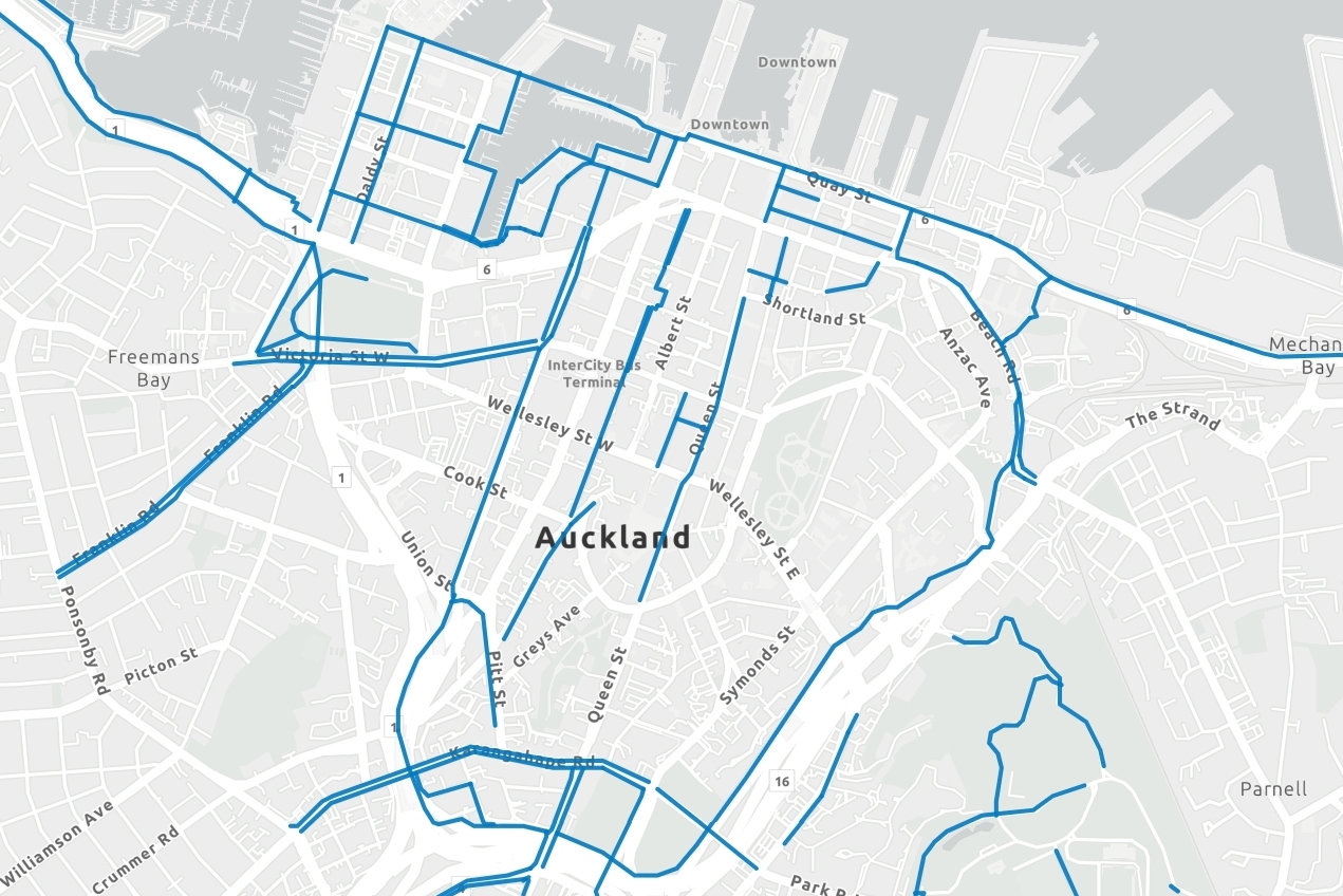
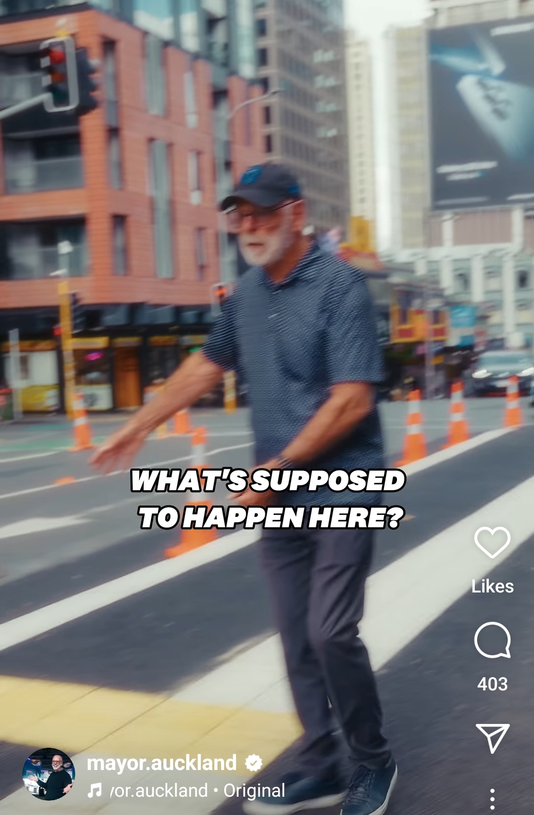
Recently, Auckland’s Mayor Wayne Brown expressed bewilderment in a social media post about the current changes to Victoria Street in the city centre.
“Welcome to Cone Central,” he says, adopting the universally recognised arms-wide position of exasperation, and gesturing around him at the works under way.
“Nobody knows what it’s for!” he adds, clearly frustrated.
Fear not, brave champion of Auckland, and others experiencing confusion: we’re here to help answer all your questions, in a special midday bulletin edition.

So, what’s it for?
Here’s the thing. To be the truly vibrant, most productive city it can be, Tāmaki Makaurau needs a city centre where people want to live, work and interact.
More people coming together means greater exchange of skills, knowledge, and ideas. This co-location of people and resources in a focused area is what makes cities the economic powerhouses that they are, as well as fun places to be.
Drawing people towards downtown Auckland requires two things:
- The city centre must be attractive relative to other places these people might otherwise choose to go to, whether other cities or their local shopping mall.
- The city’s transport system must enable movement so all of those people to get into and around the city as needed.
Fortunately these two things often interact and indeed complement each other, so they need to be considered together. Thankfully, Auckland has a comprehensive plan for addressing both: The City Centre Masterplan (CCMP).
As the CCMP website puts it:
“The CCMP is the key guiding document for the Auckland Council whānau, setting the strategic direction for the city centre over the next 20 years.
It applies the Auckland Plan to the city centre through ten outcomes, to be delivered through eight transformational moves and Access for Everyone (A4E).”
All of the many outcomes and transformational moves are great things the Mayor could get behind, but let’s focus on the one at hand:
Transformational Move 6: The Green Link
Research shows that parks and green spaces are immensely valuable for cities and the people who live there. And as Auckland’s population grows, there will be added pressure on existing parks – so improving, finding and including open space wherever we can is vital. This is especially true in built-up areas like the central city.
As the CCMP explains, it’s also crucial that people can access those green spaces:
“In 2010 the renowned Danish urban design firm Gehl Architects undertook a public life survey of Auckland city centre. This initial survey found that a lack of attractive walking routes between the city centre’s open spaces is its biggest public realm shortcoming.”
 To help improve access to green spaces and mitigate the impacts of population growth, the CCMP includes a “linear park” (Te Hā Noa) which runs between Victoria Park in the west and Albert Park in the East (and, eventually, will continue through to Wynyard Point at one end and Auckland Domain at the other, connecting a green ribbon across the heart of the city).
What’s a “linear park”, you ask? It’s a strip running through the city which provides people with access to a quieter, greener space—often within a short walk of their office.
At present, this linear park isn’t complete, but it is currently growing to form a link between Nelson Street, home to one of the city’s busiest cycleways, and Queen Street, which has a shared use path. Both of those north-south routes are extremely popular with people on bikes and e-scooters.
Connecting up this link will make it heaps easier for people to bike or scooter into the Queen Street Valley (and also gives scooter users an easy way to stay off the footpaths!).
But Victoria Street was previously a place designed for moving a lot of cars. Expanding the people space to make room for a linear park means making some changes. Those changes are planned out in the part of the CCMP called Access For Everyone (A4E).
Access For Everyone
Access For Everyone (A4E) tackles the second part of our vibrant-city checklist: Making sure everybody can move to-and-through the city centre (while still making it a great place to be).
This is a particularly tricky problem in city centres because physical space is both valuable and constrained, and the numbers of people moving around are often higher than anywhere else.

 It’s geometrically impossible to keep bringing more people into the city centre if each of those people requires a lot of physical space—like, say, the footprint of a car. A single lane of traffic in a busy place like the city centre can only move a few hundred vehicles per hour, which might translate to a thousand people a day (on a good day).
The CRL, by comparison, will have capacity for more than 50,000 people per hour. All those CRL passengers will need to be able to get from the stations to other places in the city. So footpaths and bike paths (which each can move 7,000-15,000 people per hour) are essential to connect everything up.
![]() But moving significant numbers of people at a time isn’t the only consideration. The city centre also:
But moving significant numbers of people at a time isn’t the only consideration. The city centre also:
- is the starting and ending point for numerous bus routes
- needs to enable deliveries, and
- requires pick-up and drop-off zones for taxis and rideshare services.
Altogether, the city centre transport picture is very complex, which is why A4E was developed.

The A4E plan is based on what has worked very well overseas: private vehicles can move quickly around the outside of the central city using the high-capacity motorway network, and entering the space-constrained city using the entrance/exit nearest their destination.
This frees up the routes through the city for efficient public transport, walking and cycling paths, and dynamic space for deliveries and passenger pick up.
It also means quieter streets, more space for things like trees and outdoor dining, and less air pollution—all of which help make Auckland more attractive and thus more competitive as a city.

Let’s be clear: it’s impossible to both move lots of traffic through the city centre and provide all the other functions.
Luckily, as an engineer, the Mayor no doubt has a pretty good understanding of geometry. Trying to move people through the city centre in cars is like trying to jam multiple square pegs into a round hole—it’s just not going to work.
Because buses, walking and cycling are all much more space-efficient in terms of how many people they move for each metre of road width available, they need to be prioritised in a growing city. But this doesn’t mean people can’t still drive to town: vehicle access is still provided, only without being given the majority of space on all streets.
A few outstanding questions
There is room for improvement at Victoria Street, of course. If the Mayor is interested in getting good results and finding out the answer to a few more probing questions, it might pay to ask:
1) Why are there buses on Victoria Street?
A4E is designed with bus through-routes on Albert, Symonds, Customs and Wellesley Streets. This creates key interchange locations while separating competing uses for kerb space between buses and deliveries. It also keeps bulky buses away from “paths for people”. There shouldn’t be any buses—including tourist buses—clogging up Victoria Street.
2) Why doesn’t AT open completed sections of cycleway like they do for roads and footpaths?
Whole sections are basically complete and ready to go – Queen St to Albert Park, in particular.
If AT could open this for use by people on bikes and scooters, the Mayor might have a few more answers to his question “what’s it for?”, as well as some more dynamic and appealing content for his social media posts.
3) Where is the comprehensive traffic circulation plan which shows how AT intends to implement A4E?
A4E is a high-level strategic document that instructs Auckland Transport on what we collectively need to achieve in the city centre. It’s widely supported in consultation but it’s not clear that it is widely supported by our regional transport agency. Auckland Transport should be able to clearly articulate how they will achieve A4E, and how far through the programme timeline they are.
4) Why doesn’t everybody – all the way up to the Mayor – already know this stuff?
Getting transformational projects completed is essential if we want a vibrant, thriving city. But without widespread public understanding and support, transformational projects are much more difficult. They may fall victim to misunderstanding, misinformation, or attention-grabbing electioneering.
To ensure these sorts of projects are successful, the people tasked with delivering them (in this case Auckland Transport, with support and leadership from Auckland Council) must build community literacy regarding the ‘what’ and the ‘why’.
Where is the communications programme to support A4E – and what are its success metrics?
Which brings us to one last question….
Has the Mayor forgotten he was an early champion of this project?
Back in 2023, Newsroom reported on the mayor’s “conversion on the road to Victoria Street”, and how Council gave the green light to Te Hā Noa at a time when its commencement wasn’t a sure thing:
A $50 million beautification project for CBD’s Victoria St – which will disrupt businesses from now into next year – has won urgent approval in secret from the stop-the-road-cones mayor and his cost-cutting Auckland Council.
Giving the lie to any reputation for being austere philistines, councillors have okayed a contract for one lane of traffic each way, new footpaths, trees, street furniture, a cycle lane and associated underground works on Victoria St from Federal St down and over Queen St up to Kitchener St by Albert Park.
This wasn’t just a procedural win – it was a personal coup for the Mayor, himself a city centre resident who walks to work and occasionally rides his bike around town.
“I’m a CBD ratepayer and I think this is a damn good thing,” he said. “As the only one [around the council table] who is resident in it and contributed to it, I think it is bloody good.”
Perhaps the 2025 Mayor could sit down with the 2023 Mayor to refresh his memory on the details? Maybe together they can work up an appealing set of informational social media posts, to help remind his thousands of followers that Victoria Street is on the path to success – and we just need to keep going.
Header image: Auckland Council, showing the first section of Te Hā Noa open November 2024 – as covered by Greater Auckland here.
This post, like all our work, is brought to you by the Greater Auckland crew and made possible by generous donations from our readers and fans. If you’d like to support our work, you can join our circle of supporters here, or back us on Substack!

 Processing...
That walking quote from the Danish firm is so true. We have terrible walking routes in Auckland – want to get up to Albert park? Great walk along some huge arterial on a shoddy old footpath, carparking buildings and cars turning everywhere. Victoria park – the same but worse – need to try cross the Hobson / Nelson motorway. Let’s try improve High st – some budget footpath extensions while still permitting numerous vehicles – delivery drivers just go across into Vulcan lane.
It’s slightly better now with Queen st and then obviously closer to the waterfront we have the best areas. But again, these are fragmented (wynyard bridge), the whole Port section, or non -existent – like walking past Downtown carpark on Customs st.
But i guess honestly what else can we expect from old white male yelling at the sky (cones/cycleway) and some other car brained Waitakere councillor (why is he driving to work anyway)
Flabbergasting from Wayne…he must be joking with us the ol’ curmudgeon bless him
AT are poor at communicating this, but by linking the Nelson St cycleway to midtown on Victoria St with Te Hā Noa, they are following the long established transport plan and twice Council endorsed the City Centre Masterplan strategy.
This is the ONLY east-west dedicated cycle route in the whole of the city centre between Quay St and K Rd. It is agreed to be here and here only, so other streets can be bus or car focused, with no cycling provision. This is hardly excessive, is in fact about as minimal a network as is possible.
The City Centre has a full orbital cycleway around it and this is the only way riders can access the attractions of midtown safely, otherwise they are stuck going round and round, or have to take on vehicle traffic to get to the shops etc in the Queen St valley. Only some riders will do that, we know the only way to get all types of riders to visit these locations is to make it safer.
The only departure from strategy is the inclusion of bus stops here. Buses, including tourist ones, are not meant to be on Victoria St.
Furthermore adding this section cheaply and quickly on existing road space is also following requests to add cycling infrastructure at lower cost.
These strategies and plans were developed rigorously and need to be understood as parts of a whole.
Also the extension of the cycleway to Nelson St does not take a general traffic lane, but a now disused bus lane – again, all part of the strategy of sorting the streets by mode.
Well said.
Good post. Can’t wait to see it open and A4E being implemented!
There is a local govt election looming, so politicking with bait click stories will be the norm for a while. Mr. Brown knows exactly what the Victoria will be, he’s playing it up to excite the status quo audience.
He got my vote when he wrote in the Herald that he would get rid of AT. That organisation should never have existed. They have about six different factions who all try to stop each other’s projects or try to compromise them. They call themselves SMEs or Subject Matter Experts. I am not making this up. The result is debacles like Lower Hobson St where now northbound there is two barely used bike lanes (most cyclists prefer going through the Viaduct area), a bus lane, one general traffic lane and the general traffic lane is also a loading zone. So now one truck stopping to unload blocks all the cars vans and trucks for 5 minutes. Who does this?
Interesting to assume that most cyclists prefer going through the viaduct than lower hobson st.
I use that bike lane weekly – the alternative is to go over the Wynyard Bridge which is too narrow for purpose and always clogged with pedestrians and tourists (which is great that it’s busy – but not a good cycle route).
I would love to meet a cyclist who avoids lower hobson and prefers wynyard crossing.
Same here, ride it regularly Wynyard-CBD on business and 9 times out of 10 go on lower Hobson even though I’ll be very near the bridge Wynyard side.
I do prefer over Wynyard Bridge on the off occasion I’m feeling really relaxed with time to kill since although slow you have zero traffic interactions and avoid the ludicrously designed bike lane Viaduct Harbour Ave (would love to see the drawings and who signed them off, especially with that huge granite obelisk plonked in the centre and what must be the most illegible markings humanly possible to follow).
“The result is debacles like Lower Hobson St where now northbound there is two barely used bike lanes (most cyclists prefer going through the Viaduct area)”
This is a barefaced lie. Back it up with some evidence or apologise.
The most likely ‘evidence’ you will get, will go something like this:
“I was there one night at 3:12 am and not one cyclist in sight!”
I walk through there every day on my way to work, and I always see plenty of cyclists while I’m waiting at the crossing by the Teps. Maybe Miffy is too busy staring at the brake lights of the car in front?
Lower Hobson is the obvious route between the Nelson St cycleway and the Quay St cycleway. I use it often, and it’s far easier than battling with the cruise ship and other crowds beside Portofino and Soul, etc… miffy must have a reason he’s blind to its success. Past advice went unheeded, or something?
I take it you’ll be in support of the removal of the flyover then, to make more space
Loading Zones are what businesses need. Welcome your ideas for a city centre without businesses.
As a regular commuter cyclist, I never use the Viaduct area (pedestrian heavy, slippery), instead, I use the provided cycleway. Ok, some pedestrians and couriers/delivery people still just step into the cycleway so it isn’t a fast cycling route so my bell is very handy. I nearly always share the route with other cyclists and micro-mobility users. So “barely used” is not at all accurate.
Who goes through the Viaduct rather than along roads? I do. Yes, even though it is longer, bumpier, and more convoluted, it is nicer. It has views of the harbour, of people walking, of scents and smells of the sea, sounds of bricks rattling as you ride over them. Sometimes we just want to take the long way home. Not everything needs to be fast.
Good on you. And I agree, it is nice to go through the Viaduct and see all the activity going on.
So that answers the question Mitch had (I love to meet…).
It does not, however, clear miffy’s statement that Lower Hobson St is a ‘debacle’ with ‘two barely used bike lanes’. That’s still really just an unproven rant not backed up by facts.
In addition, it’s a clearway from 6-9am and 4-7pm so no unloading during those times (unless that has changed recently). Whether or not those times should be extended is a different matter; I’m sure this is being monitored and those times will be extended when evidence points to that.
Lol literally everything in this comment is wrong
That A4E diagram is taking the piss a bit isn’t it? The idea seems to be one can access and move between the local neighborhoods by car through the arrows shown. The problem is, taken literally, there’s no way those access points could all exist! For example, it shows an access point to K Road from the West side by the ring road. I think we can all agree it would be crazy to try to add motorway access points to K road West! At first glance the other points seem more reasonable, although I’m not sure there’s two way on and off ramps at each of those access points. In reality the best we can do is perhaps 2-3 neighborhoods divided by Queen St and Victoria St West.
It’s an elegant idea, and it reframed the way I look at the CBD since you first publicized that image a few years ago. But I think it wasn’t drawn with the seriousness it is being presented.
I use this bike lane daily and there’s heaps of people free flowing on it. Quay St shouldn’t be heavily used, so why increase the supply of cars onto it.
If the mayor wants to know what’s going on with Victoria Street, he should go ask the guy who advocated and voted for the changes when Auckland Council approved the funding. His name is Wayne Brown and you can find him in the mayoral office at auckland council.
OMG I’ve been waiting for years for this wonderful greenway to be completed between Albert and Victoria Parks. Mr Mayor = please, please, please don’t stop it.
Did his PR agency say it’s time for another rant Wayne? Your boomer supporters would love to see you standing around on an installation you approved raving to the seagulls.
Ridiculous.
Old mates just ramping up people who never go to the CBDs anger ready for his crack at a 2nd term.
I think that he’s done an alright job as mayor, but this little stunt makes him look like a silly old bugger.
He’s been pretty shit. Floods were abysmal, and he hasn’t really achieved anything else apart from flogging off a few assets.
How do deranged rants every now then outweigh blatant incompetence during an emergency?
I had been starting to warm to the idea of a second term for Wayne Brown. But he can kiss my support good bye. He knows perfectly well what the answers to his questions are but deliberately chooses to pretend not. This is not the type of politician that I will tolerate anymore.
Ha, council funded and led project. Being delivered by AT. Mayor doesn’t even know about. And he wants to have more control over transport projects. Hahahahhahha
For Outstanding Questions:
1) AT might be able to move service buses off Victoria St, but hotels have their requirements.
2) Maybe inspections and formal resolutions are still needed before opening new sections of cycle path.
3) A lot of City Centre coordination goes on, with all the different projects that make up the whole A4E picture, not forgetting the major building developments and their cones. Some of that sequencing is fluid until Council approves the funding for each piece. And details need to be negotiated with the communities affected. Perhaps Council can provide some full picture updates – it’s not AT that can do that alone.
4) I think everybody does – or did once.
Love the post. A cheap, tired, leadership void is certainly uninspiring.
And another point is this: when the Councillors agree on something like CCMP and A4E, (or C40 or TERP, etc), their decision is a direction to the CEO.
A CEO given such a strategic direction must be a leader of change. Not a manager of status quo systems and processes that cannot deliver the new direction.
The excuses I hear about why a CEO is allowed to remain a defender of the status quo are, I believe, a core part of the mindset holding NZ back.
I read Wayne having a moan in an NZ Herald article this morning. It all sounded like he was being a bit obtuse, which is disappointing.
Even more infuriating though, was old mate Cllr Ken Turner. He was having a moan about it taking 90 minutes to drive from Little Huia way out west into the city, and 30 minutes of that was sitting in downtown traffic. Ken has a business in Woodlands Park. If he was concerned about wasting time in traffic or reducing congestion, he would park his car at his business and catch the bus into New Lynn, then either take a train into the city, or a bus.
He wouldn’t have gotten his picture in the paper though, and it’s an election year, and that’s more important.
Wayne Brown is acting like Ken Turner, with his “I don’t understand” rubbish.
The guy seems pretty well loaded, but he rides what looks like a mid 2000’s hybrid bike picked up at a garage sale. I imagined him on a roadie, or top spec e-bike.
Only two Waynes is, one supporting what he supports and one trying to get reelected
Thank you for this article. In the absence of logic and wisdom, folly prevails.
When election is coming, Wayne brown starts to “pretend” to work. Where was he in the past few years? We’ve seen how incompetent he is in solving the flood recovery – 2 years in and not even done. Not to mention he was acting like a spoilt brat, no leadership at all whining about missing his tennis match.
He is only good at putting a couple of swimming lanes on Wynyard Quarter, which wasted taxpayers money $500,000 and he claimed to be a good spend – meanwhile he took away all the rubbish bin from our parks & public places. And the change of rubbish collection to fortnightly is coming under this guy watch. Say no to wayne brown.
Mayor Brown knows all of this. He’s being intentionally obtuse for attention.